
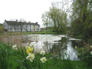
The parish of Kilwick is situated in what was once the wapentake of Dickering, part of the historical East Riding of Yorkshire (see maps in Introduction); its boundaries remained unchanged after the 1832 parish boundary changes. The parish had two centres of population: Kilham and Swaythorpe. Only earthworks remain of the latter medieval village, though its name survives in the neighbouring farm built in the mid 1800s. It is one of a handful of farms scattered across this rural parish made up essentially of farm land. Kilham is now the only centre of population. It lies on a Roman road connecting York and Bridlington, which to the east of the village follows a low ridge of the Yorkshire Wolds known as Woldgate. Kilham was one of the largest and wealthiest villages in the wapentake during the Middle Ages, an important trading centre with a much larger population that it has today. The village owes its decline to the easier access provided to Driffield by the building of the Driffield Navigation, a waterway made up of a canal and the river Hull which gives direct access to the Humber estuary.
Midway between Kilham and Langtoft, is an interesting feature called Henpit Hole, where an intermittent spring called a gipsey emerges. (The word is derived from the Old Norse word geysa, meaning to gush, which gave rise to the universal geyser, the “g” being pronounced in the same way.) Gipseys are typical of Wolds country and the one at Kilham is no exception. At intervals of a few years it used to spurt forth with such force that a man on horseback could pass through the arch formed by the water without getting wet. According to tradition, Henpit Hole was so called after a hen that was spurted out there. The phenomenon can be explained by the accumulation of water in an underground cavern that is connected to the surface by a siphon. Once the water reaches the top of the siphon it is expelled with force and continues to flow until the supply is exhausted. Its intermittent nature is probably due to the porosity of the chalk which makes up the Wolds. As most of the water drains away, filling the cavern to bursting point must take many months. Since the draining of the surrounding countryside, the flow has been much less copious – and nowadays motor vehicles are more common in the area than men on horseback.
The former importance of Kilham is reflected in its four manors. Although their lands were all recorded as waste in Domesday, two of the manors became known as the royal manor. In 1066 one had been in the hands of Earl Morcar and the other shared among four Saxon thegns, but by 1086 the lord and tenant in chief of both was King William. A third manor, owned in 1066 by Ernwin the priest and retained by him in 1086, came into the hands of the monarch soon after the completion of the survey. All three manors were granted by the king to the archbishop and chapter of Rouen, and they were destined to alternate in ownership between the two parties according to whether a state of war or peace existed between the English and French kings. In 1334 they were finally granted to William of Melton, the archbishop of York, in whose family they remained until the early 1500s. Thereafter they passed by marriage through a number of local families until they were sold to the Sykes family, after which they were split into smaller lots and dispersed. The fourth manor, originally owned by Forne, son of Sigulf, and Gamal, was awarded to Odo the bowman. It passed into the Chauncy fee until in 1356 it was also granted to William de Melton, thereafter following the same descent as the other three manors.
The church at Kilham is dedicated to All Saints. The building is one of the largest of the earlier Wold churches and is a stone structure in the Early English style, comprising a nave, chancel, south porch and tower. The nave is built on the site of the former Norman church and follows its wide plan; it is devoid of aisles or chapels and has plain windows. The sculptured corbels on the north and south walls of the nave are vestiges of the ancient church, as is the 12th century tub font with its incised arcading. In contrast, the windows of the 14th century chancel are pointed with intersecting tracery under hood moulds. The inner door surround in the south porch is another splendid fragment from the Norman church. It takes the form of an arch of seven chevron mouldings resting on cylinders, above which are sculptures in diamond-shaped panels. The massive square western tower is crenellated and strengthened by angular buttresses; it has some fine reused vaulting in the interior walls and contains three bells.
 right: nave and chancel – © awmc1, 2010 |  |  |  left: font – © Maigheach-gheal, 2007 |
Members of two branches of Puckering family are associated with Kilham. It seems that Jane Puckering of the 2nd generation of the P-ckerings of Hutton Magna moved from Weaverthorpe to Kilham to give birth to and baptise her three children there between 1814 and 1821. The two daughters and one son bore the name Puckering as their father’s name was not recorded and all three were probably brought up in the village. They eventually moved to Sherburn. William Puckering of the 14th generation of the Puckerings of Driffield, moved from Driffield to Kilham in c1855, where he was employed as a shepherd, and the last fifteen of his seventeen children were born there between 1856 and 1879. After his death and burial in the village in 1907, his widow Frances emigrated with nine of her surviving children to Australia, where their descendants flourish in Bundaberg in the state of Queensland. One son emigrated to the state of Ontario in Canada and the others remained in England.
Sources:
https://www.genuki.org.uk/big/eng/YKS/ERY/Kilham
https://intel-hub.eastriding.gov.uk/parish-profile/#/view-report/bd6a0cb7f85a46998f874a42bfd0dc8e/PP082
https://en.wikipedia.org/wiki/Kilham,_East_Riding_of_Yorkshire
https://en.wikipedia.org/wiki/Woldgate
https://en.wikipedia.org/wiki/Driffield_Navigation
https://opendomesday.org/place/TA0664/kilham
Victoria History of the County of York, East Riding, vol. 2, pp. 251-255
History and Topography of Yorkshire, York, Ainsty, East Riding, vol. 2, pp. 481-3: https://books.google.fr/books/about/History_and_topography_of_the_city_of_Yo.html?id=3cEHAAAAQAAJ
Bulmer’s History, Topography and Directory of East Yorkshire with Hull 1892, pp. 219-222: https://specialcollections.le.ac.uk/digital/collection/p16445coll4/id/324025
https://www.vikingsofbjornstad.com/Old_Norse_Dictionary_N2E.shtm
Church of All Saints: https://historicengland.org.uk/listing/the-list/list-entry/1309840?section=official-list-entry
All Saints, Kilham, Yorkshire, East Riding: https://www.crsbi.ac.uk/view-item?i=11374