
Victoria History of the County of York, East Riding, vol. 5
courtesy of Martin Craven
The parish of Preston is situated in what was once the wapentake of Holderness (middle division), part of the historical East Riding of Yorkshire (see maps in Introduction). Before the 1832 parish boundary changes it included the sub-parish of Lelley, which was separated from the main body by the northern part of the parish of Skeckling cum Burstwick. Lelley became a parish in its own right in 1866, but finally merged with the parish of Elstronwick in 1935.
Much of Preston parish lies less than seven metres above sea level, making it liable to flooding. Banks were therefore built and the land was drained, the main drains being Old fleet and New fleet that flow into the Humber estuary at Preston haven and Hedon haven respectively. The village of Preston originally had a linear plan, the old enclosures extending along most of the east-west road which separated North Field from South Field, both of which were mentioned in the late 13th century. Part of the old road still exists as a path called Nuns’ Walk, which ends abruptly opposite the church at the north-south axis which became the principal road through the village at the new enclosures of 1777. Once called Kirkeholme Street, it later became Main Street, along which housing was concentrated in the 18th and 19th centuries. Part of the churchyard was taken over to widen it in 1831, which accounts for the sharp bend around the church tower that it retains to this day.
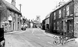 looking north, © Francis Frith |  looking north | 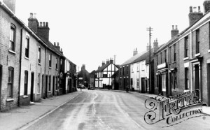 looking south, © Francis Frith | 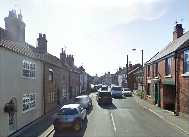 looking south, © Google Maps |
In 1066 eight men had eight small holdings in Preston, which had passed into the lordship of Baldwin of Flanders by 1086. At the same time Earl Tostig’s manor of Burstwick included, among other settlements, Lelley and a holding in Preston. By 1086 all these holdings were in the hands of the king’s tenant in chief Drogo de la Beuvrière as part of his single holding of Holderness, which later descended in the Aumale family. In the 12th century William le Gros, then Count of Aumale, appropriated land in Preston and Burstwick to found his new town of Hedon. This meant that not only were the original lands of Preston reduced, but some of its remaining lands were also given to the leper hospital of St. Sepulchre lying between Preston and Hedon, to St. Mary Magdalen hospital at Newton Garth, Paull, to Meaux Abbey at Wawne and to Thornton Abbey in northern Lincolnshire. The lordship of the Aumales had come to an end by the late 13th century when their lands had passed to the Crown; these were followed by the above mentioned ecclesiastical institutions at the Dissolution in the mid 16th century. Thereafter the Crown awarded its lands in Preston and Lelley to local families, including the Constables and Chichester-Constables and the Hildyards.
Preston can be assumed to have been an important ecclesiastical centre before the Conquest, as the Domesday survey records a church there and the name of the village is a contraction of “priest’s town”. In 1115 Preston church was among those given to Aumale abbey, but it was later ceded to the archbishop of York, who endowed the subdeanery with it in 1228. A vicar had been appointed by the 1260s who also served Hedon. Robert de Pickering, a member of a junior line of the Pickerings of Oswaldkirk, was the holder of the office in 1363. In the meantime, in 1293, Preston church had taken the name All Saints. The church today consists of a 13th century chancel, rebuilt in the early 14th century, with a 15th century north chapel, an aisled and clerestoried nave from the 15th to 16th centuries and a 16th century four stage west tower. The structure is made largely of boulders, clad on the exterior with ashlar and rubble, whereas the interior was covered in plaster which was only removed in 1982. Extensive restoration work was undertaken in 1880, when pieces of carved alabaster dating from the 15th century were found and are now displayed in the south aisle.
 | 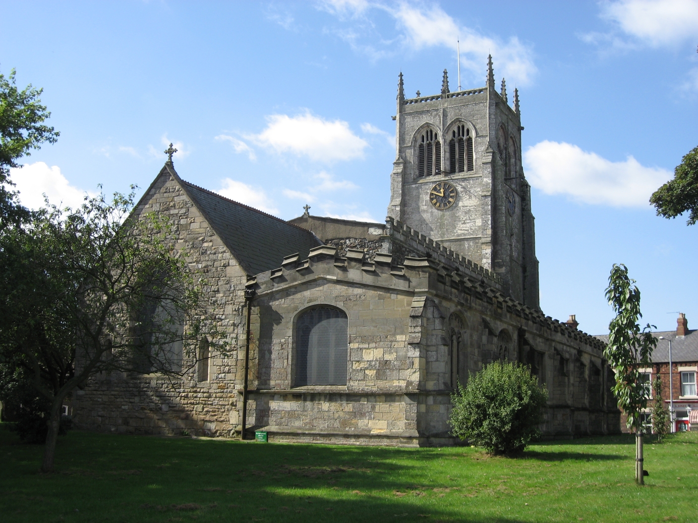 above: from the east left: tower and south door |  right: tower from Nuns' Walk, 2007 |  |
A chantry at the altar of St. Mary was founded in 1341 by Hugh de Preston, the parson of Halsham, who obtained a grant from king Edward III for a priest “perpetually to celebrate thereat for the souls of the said king, the canons of York, and of M. Rt. de Pickering, and the soul of the said Hugh de Preston, and his parents, &c.”. Master Robert de Pickering, the former Dean of York and Archdeacon of Nottingham, had died in 1332. He was a member of the 9th generation of the Brus / Bruce family who, as was the custom, had taken the name of the town in which he was ordained. The chantry became known as Pickering’s chantry and the office of chantry priest was occupied for two centuries from its founding to the Dissolution.
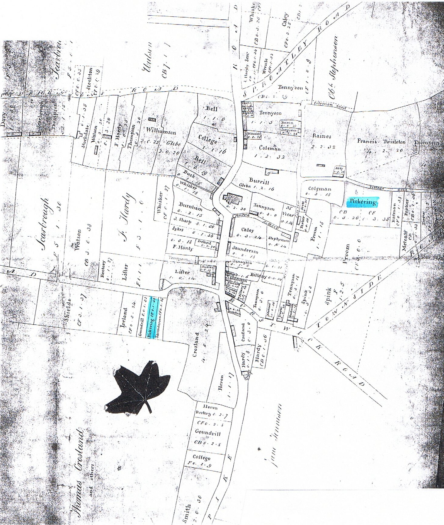
In the 1730s William Pickering of Hutton Cranswick, a member of the 21st generation of the Pickerings of Holderness, established himself in Preston as a bricklayer, married there and had eight children. His eldest son, also William, was baptised in Preston in 1743 and became the founder of the Pickerings of Sledmere, but his siblings remained in Preston, as did their descendants for another two generations. At enclosure in 1777 three plots in Preston were awarded to Pickerings, two along Cottage Road (now Manor Road) and one on Staithes Road.
Sources:
https://www.genuki.org.uk/big/eng/YKS/ERY/Preston
https://intel-hub.eastriding.gov.uk/parish-profile/#/view-report/bd6a0cb7f85a46998f874a42bfd0dc8e/PP114
https://en.wikipedia.org/wiki/Preston,_East_Riding_of_Yorkshire
https://en.wikipedia.org/wiki/Lelley
https://opendomesday.org/place/TA1830/preston
Victoria History of the County of York, East Riding, vol. 5, pp. 186-201 (not online)
The History and Antiquities of the Seigniory of Holderness vol. 2, pp. 181-196: https://archive.org/details/historyantiquiti02poul/page/181
The Buildings of England, York and the East Riding, pp. 652-653: https://archive.org/details/yorkshireyorkeas0000pevs/page/652
Church of All Saints: https://historicengland.org.uk/listing/the-list/list-entry/1083438?section=official-list-entry
Discovery at Preston in Holderness, Yorkshire Archaeological Journal, vol. 7, p. 286: https://archive.org/details/YAJ007/page/286