The parish of Preston is situated in what was once the wapentake of Holderness (middle division), part of the historical East Riding of Yorkshire (see maps in Introduction). It can be assumed to have been an important ecclesiastical centre before the Norman Conquest, as its name is a contraction of “priest’s town”. Domesday records Baldwin of Flanders as its lord in 1086, himself a vassal of Drogo of la Beuvrière, Lord of Holderness, along with 56 villagers, 7 smallholders and 3 men-at-arms, adding “there is a priest here and a church”. Initially the hamlet of Lelley formed a detached part of Preston and was mentioned separately in Domesday.
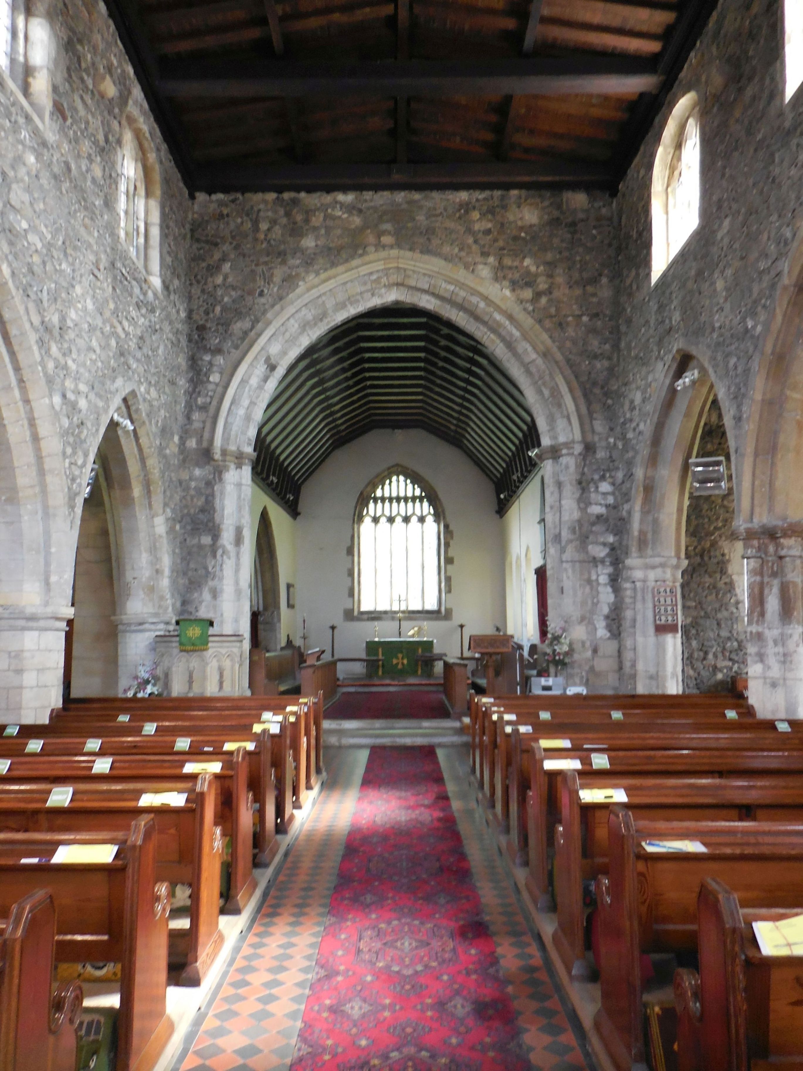
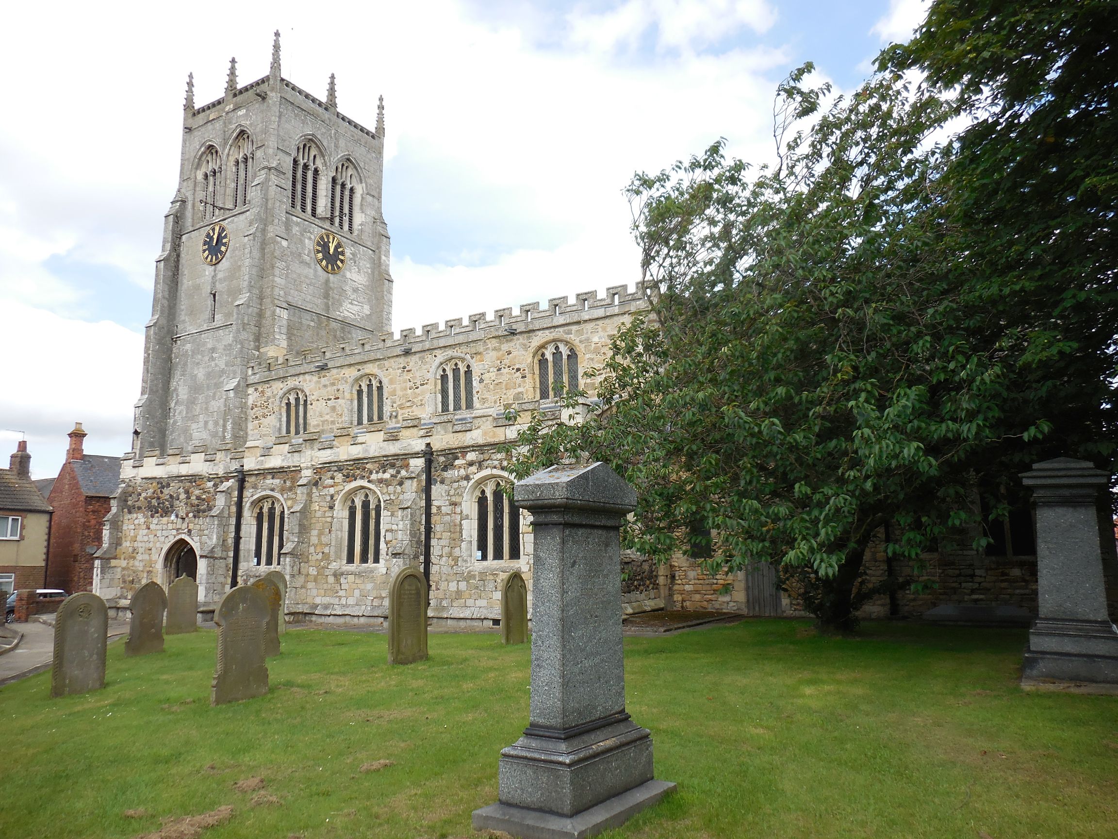
In 1115 the church at Preston was among those given to Aumale abbey (see Hedon), but it was later ceded to the archbishop of York, who endowed the subdeanery with it in 1228. A vicarage had been ordained by the 1260s, and one of the holders of the office (1363) was Robert de Pickering, member of a junior line of the Pickerings of Oswaldkirk. The vicars of Preston also served Hedon. In 1293 Preston church took the name of All Saints. The building consists of a chancel with a north chapel, an aisled and clerestoried nave and a west tower. It is largely built of boulders, the exterior being clad in ashlar and rubble, whereas the interior had its plaster covering removed in 1982. The chancel was rebuilt in the early 14th century, but retains earlier lancet windows, and the north aisle was added soon afterwards. The north chapel dates from the 15th century and was perhaps built on the site of a chantry in honour of the Virgin Mary. The chantry was founded in 1341 by Hugh of Preston, the parson of Halsham, who obtained a grant from king Edward III for a priest “perpetually to celebrate thereat for the souls of the said king, the canons of York, and of M. Robert of Pickering (Master Robert of Pickering, Dean of York, Archdeacon of Nottingham, died 1332), and the soul of the said Hugh de Preston, and his parents, &c.”. The Robert de Pickering referred to here was in fact a member of the de Brus family who, as was the custom, took the name of his home town once ordained (see Master Robert of Pickering, Dean of York, and Archdeacon of Nottingham in the 9th generation of the de Brus / Bruce family). The chantry became known as Pickering’s chantry and the office of chantry priest was occupied for at least two centuries after its founding. In the early 16th century the south aisle, clerestory and pinnacled tower were added to the church. Extensive restoration work was undertaken in the 1800s.
 | 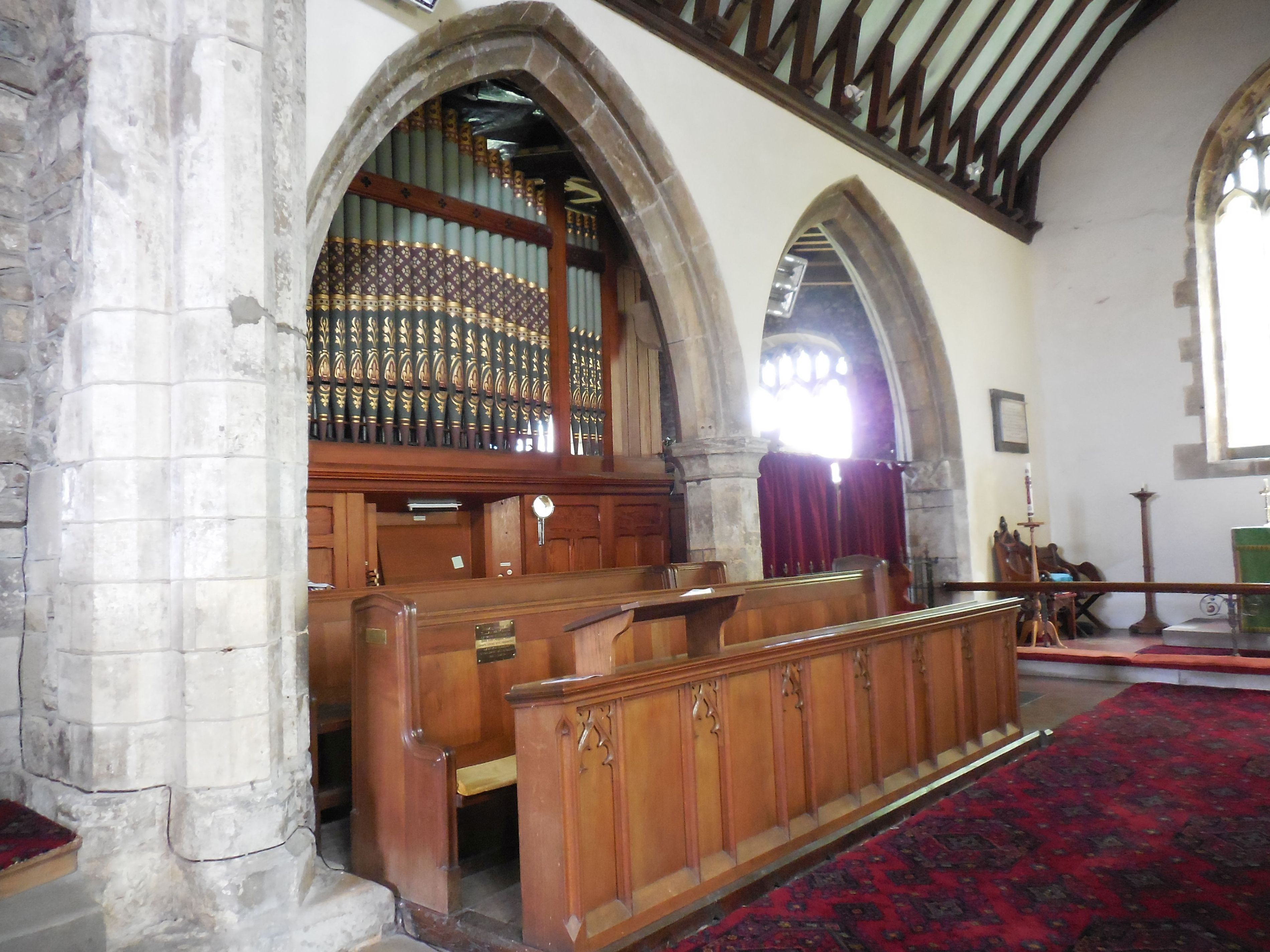 organ and entrance to the north aisle formerly Pickering's chantry now the vestry | 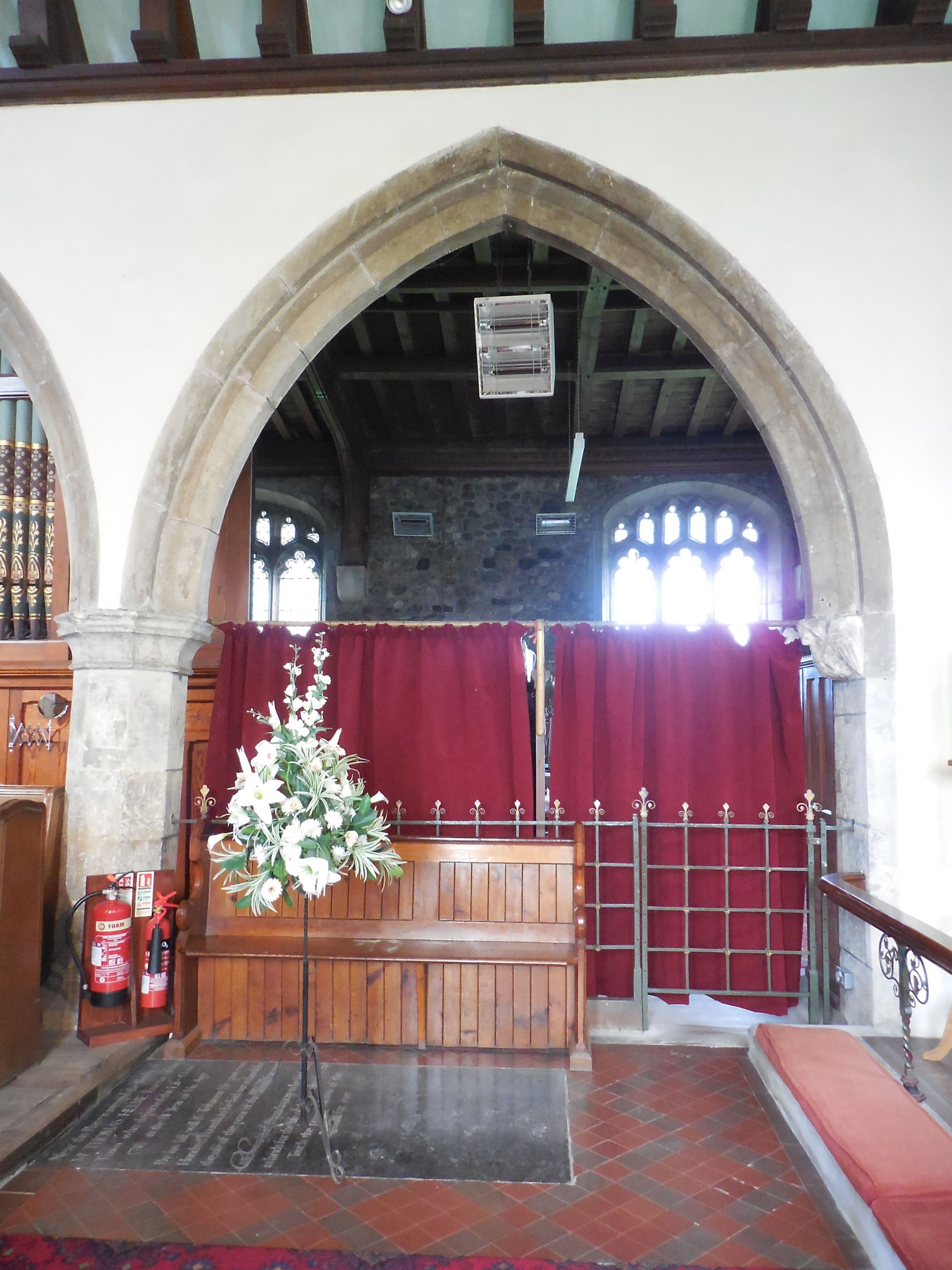 | 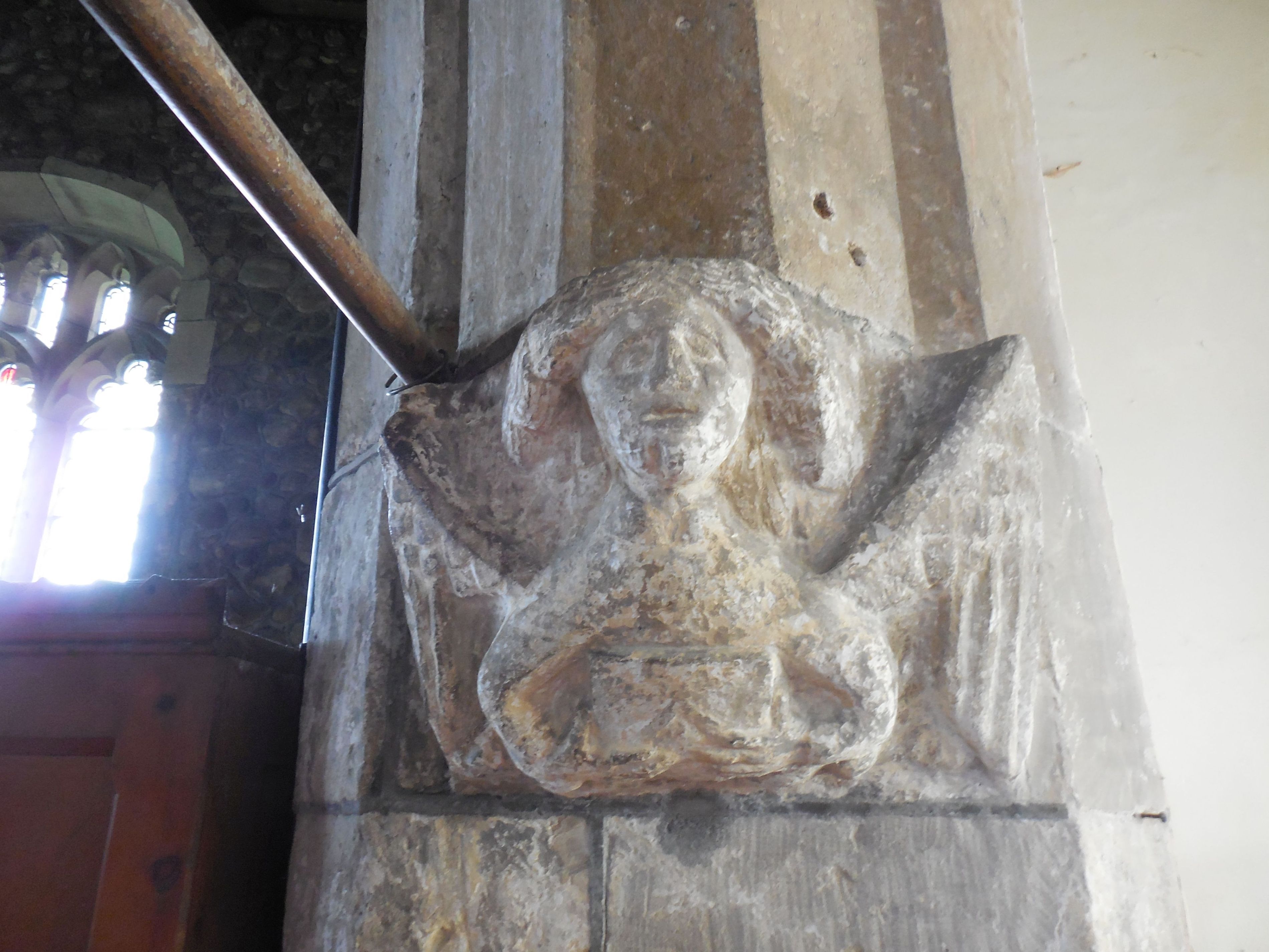 entrance to the north aisle, 2016 formerly Pickering's chantry now the vestry |
 |  south aisle | 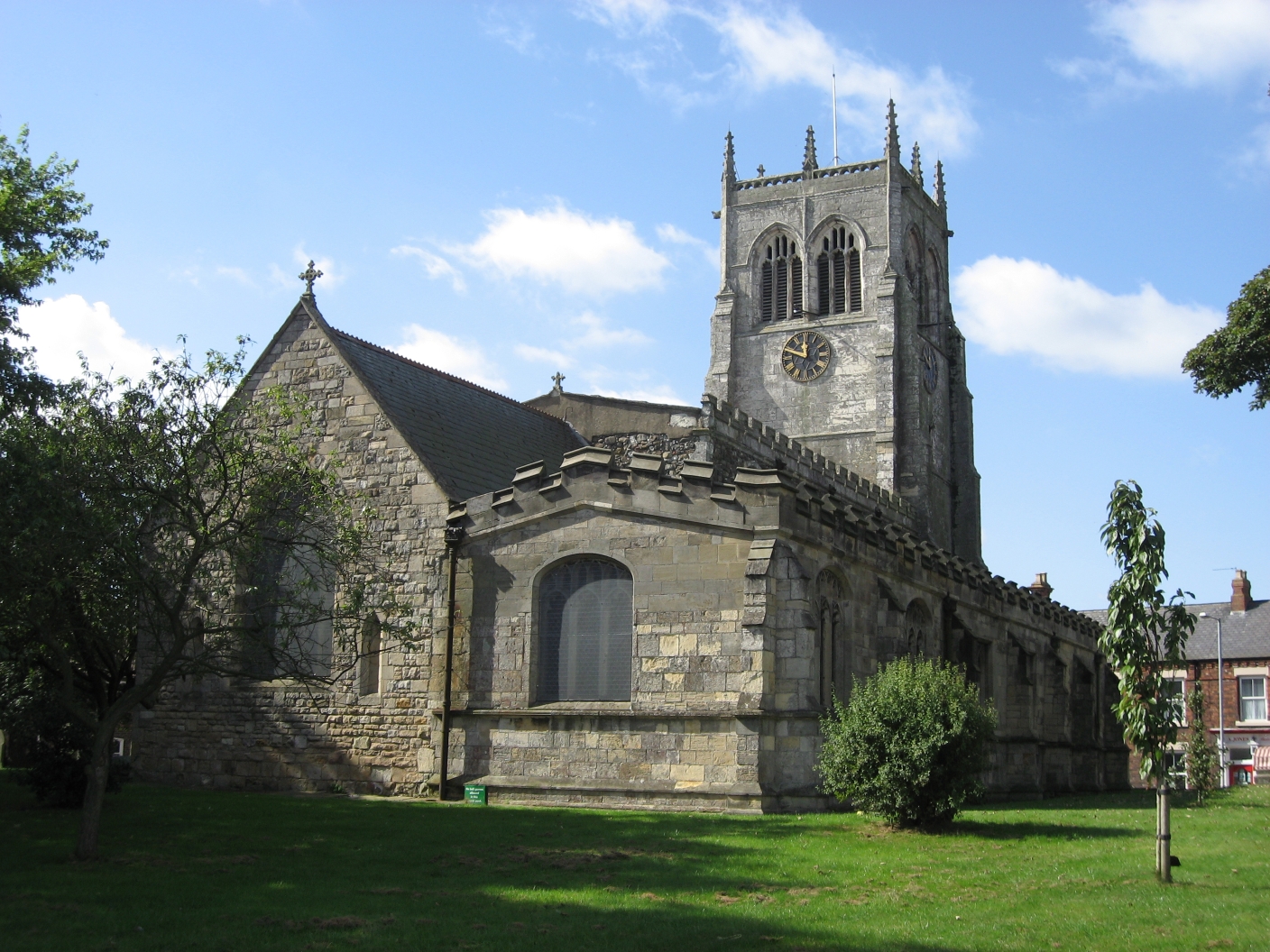 north chapel and aisle | 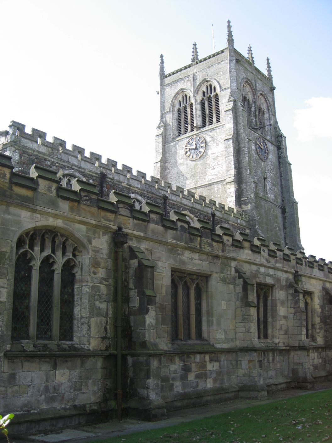 |

The Victoria History of the Counties of England
Arable land was already extensive in 1086 and agriculture remained the principal activity in Preston until the 20th century, although some weaving took place between the 16th and 19th centuries. Much of the parish lies less than 7m above sea level so, to protect it from flooding, banks were built and the land was drained, the main drains being Old fleet and New fleet that flow respectively into the Humber estuary and Hedon haven. There is evidence that they were used for the shipment of grain in the 16th century and coal in the 17th.
The area of Preston parish was reduced by the establishment of Hedon in the 12th century, and the detached parts of Dyke and Lelley did not compensate for this loss, as Dyke became depopulated and Lelley was eventually transferred to the neighbouring parish of Elstonwick. There were 371 poll tax payers at Preston in 1377, and the village contained 81 houses in 1438. Ninety households were listed in the hearth-tax return of 1673, the figure rising to 140 families in 1743 and 160 in 1764. Over the following centuries the population rose steadily to reach 1,422 in 1921, it exceeded 2000 in 1951, dipped in 1971, and stood at 3,258 at the time of the 2011 census.
courtesy of Martin Craven
Preston has long been well served by roads, an early one being the route connecting the village to Preston staith or stakes, later straightened and named Staithes Road. Another route ran from Preston to Marfleet and thereafter to Hull, but in the 1700s the main road to Hull ran via Bilton, and it was not until 1830 that Preston could benefit from the more direct route linking Hedon with Hull which was built through its southern end.
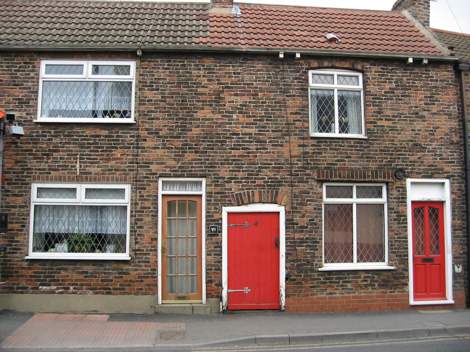
Pickering house?
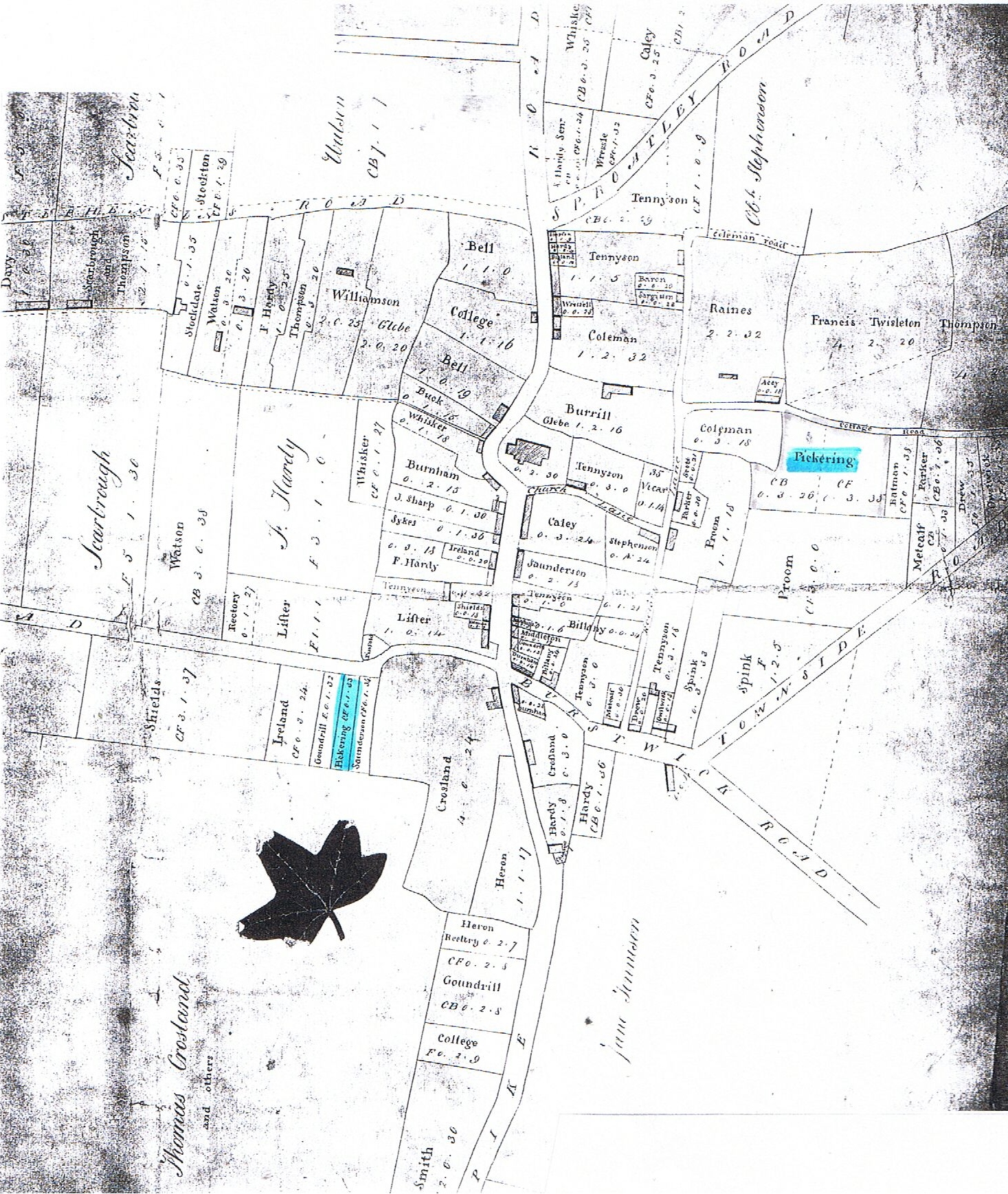
Like many Holderness villages Preston has a linear plan, and the old enclosures extended along most of the east-west road which separates North Field from South Field, both areas having already been mentioned in the late 13th century. The new enclosures of 1777 brought about many changes, including the village’s orientation along the north-south axis called Kirkeholme Street (later Main Street), which had been turnpiked in 1745. Housing was concentrated along this road in the 18th and 19th centuries and part of All Saints’ churchyard was taken over to widen it in 1831, though it retains a sharp bend to this day. Three plots were awarded to Pickerings in 1777, two along Cottage Road (now Manor Road) and one on Staithes Road. William Pickering (1714-1770) of Hutton Cranswick (Pickerings of Holderness, 21st generation) was already established in the town as a bricklayer, and by the time of the new enclosures his sons William and Michael had followed him in the trade, Michael also having a licence to sell ale in 1776 and 1777.
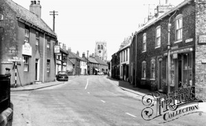 looking north, © Francis Frith |  looking north | 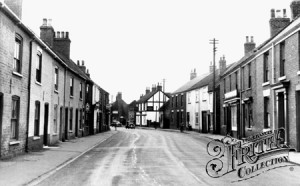 looking south, © Francis Frith | 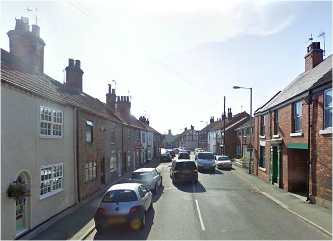 looking south, Google Maps |
Sources:
The Domesday Book: https://opendomesday.org/place/TA1830/preston
All Saints, Preston: http://www.imagesofengland.org.uk/Details/Default.aspx?id=166663
The Victoria History of the Counties of England, University of London, 1984
The History and Antiquities of the Seignory of Holderness vol. 2, George Poulson: https://archive.org/details/historyantiquiti02poul
http://en.wikipedia.org/wiki/Preston,_East_Riding_of_Yorkshire